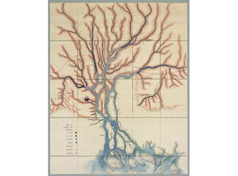
愛知県耕地整理統計図
Takagi Family Documents Digital Library
Number
45
Title
愛知県耕地整理統計図
Date
大正5年5月24日発行
Year
1916
Creator
発行所・愛知県内務部
Type
冊子
Size
22.0×15.1
Quantity
1
Note
愛知県耕地整理施行地累年比較表及施行種別一覧(大正5年3月末調)、各府県高知整理施行地面積並ニ換地交付面積ノ比較表(大正4年6月調)、愛知県耕地整理施行地面積比較図(大正5年3月末現在)、愛知県耕地整理施行地略図(大正5年3月末調)、悠紀斎田附近実測図)
Call number
小寺18-41
Documents
小寺家文書
Use
資料画像を個人的な利用の範囲を超えて二次的に使用する場合は、事前に所蔵者の許可を得る必要があります
Original Owner
Ogaki City
Source
Nagoya University Library
Material type
OldDocument
Image
None
Collection
Takagi Family Documents Digital Library
This is a collection of documents formerly owned by the Hatamoto Takagi family, who were responsible for flood control in The Kiso Three Rivers basin during the Edo period.(Partially Important Cultural Properties.)
Original Owner
Ogaki City
Use of Content
Please click here
related items
〔耕地整理講習会記録〕
Takagi Family Documents Digital Library Ogaki City
〔「多良村耕地整理組合」罫紙、未記入〕
Takagi Family Documents Digital Library Ogaki City
〔耕地整理事務開始日時につき通達書〕
Takagi Family Documents Digital Library Ogaki City
〔多良村第一耕地整理組合会議員当選通知書〕
Takagi Family Documents Digital Library Ogaki City
〔耕地整理施行反別・経費につき尋ねたいため出頭依頼状〕
Takagi Family Documents Digital Library Ogaki City
〔耕地整理資金500円の仮借用証書〕
Takagi Family Documents Digital Library Ogaki City

